A Tornado Watch Covers Washington and Baltimore as Severe Storms Race Up the I-95 Corridor With 75mph Gusts Forecast
The watch ran until 10pm across six states and DC, with forecasters warning of a couple of tornadoes, large hail and damaging winds along the East Coast.
Commentary & Analysis ·
Verified key facts
- A tornado watch was issued at about 3pm on Thursday, in effect until 10pm, covering parts of Delaware, the District of Columbia, Maryland, New Jersey, Pennsylvania and Virginia, per WJLA and WBAL-TV
- The Storm Prediction Center placed the region under a Level 2 of 5 'slight' risk for severe weather, per WTOP
- Forecasters warned of a couple of tornadoes, isolated hail up to ping-pong-ball size and scattered wind gusts of up to 75mph, according to WTOP
- Storms were forecast to be most intense along and east of the I-95 corridor, reaching the Capital Beltway between about 4pm and 7pm, per the Baltimore Sun
- The tornado threat was assessed as highest in northeast Maryland, according to the Baltimore Sun
- Some schools in the DC area dismissed students early ahead of the storms, NBC4 Washington reported
Six states and the capital under one watch
The National Weather Service placed Washington DC, Baltimore and a broad slice of the mid-Atlantic under a tornado watch on Thursday afternoon as a line of strong to severe thunderstorms swept towards the Eastern Seaboard. The watch, issued at about 3pm and running until 10pm, covered parts of Delaware, the District of Columbia, Maryland, New Jersey, Pennsylvania and Virginia, according to WJLA.
A separate severe thunderstorm watch covered adjoining areas over the same window. WBAL-TV in Baltimore ran live coverage as the watch took effect across central Maryland, while WTOP reported that the Storm Prediction Center had placed the region under a Level 2 of 5 — 'slight' — risk for severe weather, a category that routinely produces damaging storms despite its modest name.
What forecasters said the storms could do
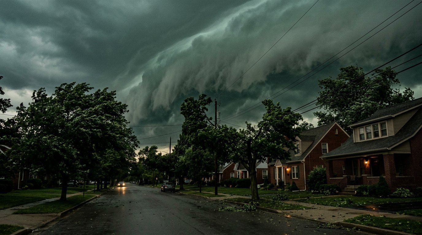
The threat menu was a familiar late-summer cocktail for the region, but an unusually potent one. WTOP reported that forecasters expected 'a couple' of tornadoes, isolated hail as large as ping-pong balls, and scattered wind gusts of up to 75mph — hurricane-force in straight-line form, and comfortably strong enough to bring down trees and power lines.
Damaging wind was flagged as the primary hazard, as it usually is when a squall line crosses the mid-Atlantic. The Baltimore Sun reported that the tornado threat was assessed as highest in northeast Maryland, where wind shear along the advancing line offered the best chance for embedded circulations to spin up.
Timed for the evening commute
The storms could hardly have picked a worse arrival window. The Baltimore Sun reported that the line was expected to be most intense and widespread along and east of the I-95 corridor — the spine connecting Washington, Baltimore and Philadelphia — with the strongest cells reaching the Capital Beltway between about 4pm and 7pm, squarely across the evening rush.
Fox 5 DC warned of thunderstorms with heavy downpours throughout the afternoon and evening, with a tornado warning issued in Maryland as the line advanced. Torrential rain on sun-heated August pavements brought the additional threat of flash flooding, particularly in the low-lying, heavily paved corridors inside the Beltway.
Schools out early, region on alert
The approaching weather rearranged the region's afternoon before the first thunder arrived. NBC4 Washington reported that some schools in the DC area dismissed students early so that buses would be off the roads before the line's forecast arrival. Arlington's local outlet ARLnow relayed both the severe thunderstorm and tornado watches to a county that sits directly on the storms' projected path.
In Fairfax County, Virginia, FFXnow reported the dual watches in effect through the evening. The pattern of local coverage — Arlington, Fairfax, Baltimore, southern Maryland — traced the geographic breadth of the threat, from the Virginia suburbs through the District to the Chesapeake shore.
Why August squall lines hit this region hard
The mid-Atlantic's severe weather season peaks in high summer, when tropical humidity from the Atlantic and the Chesapeake meets cold fronts dropping out of the Ohio Valley. The result is fast-moving lines of storms that gather strength over the Appalachian foothills and accelerate towards the coast, arriving with little of the visual warning that precedes storms on the open Plains.
The region's dense tree canopy and above-ground power infrastructure make it unusually vulnerable to precisely the hazard forecasters emphasised on Thursday: damaging straight-line wind. Gusts in the 60-75mph range routinely produce six-figure outage counts across Pepco, Dominion and BGE territory, which is why utilities pre-stage crews when the Storm Prediction Center highlights the corridor.
A watch is not a warning — but it earned one
Meteorologists are careful about the distinction: a watch means conditions favour severe storms; a warning means one is happening. Thursday delivered both, with Fox 5 DC reporting tornado warnings triggered in Maryland as storms crossed the region, alongside severe thunderstorm warnings as the line moved through.
For residents, the practical guidance repeated across every outlet was the standard playbook: stay off the roads during the line's passage, move to an interior room on the lowest floor if a tornado warning is issued, and treat every downed wire as live. The compressed timing — a few violent hours rather than a prolonged siege — is typical of these events.
After the 10pm expiry, the clean-up count begins
The watch was set to expire at 10pm as the line cleared the coast, leaving the region to take stock overnight: outage numbers, wind reports, and whether the National Weather Service would need to send survey teams to confirm any tornado touchdowns in northeast Maryland, where the rotation risk had been greatest.
Friday's picture for the DC and Baltimore area was expected to be calmer behind the front. The evening's storms were another entry in a summer that has repeatedly tested the East Coast's grid and its commuters — and a reminder that the region's most damaging weather often arrives not from hurricanes but from six furious hours on an August afternoon.
Sources
- WTOP - Tornado watch in effect as gusty thunderstorms pound DC region Thursday
- The Baltimore Sun - Tornado watch in effect as strong to severe storms threaten region
- WBAL-TV - Live updates: Tornado watch for Central Maryland until 10 p.m.
- NBC4 Washington - Live coverage: Tornado watch issued in DC area amid severe storms
- WJLA - Weather Alert: Tornado & Severe Thunderstorm Watch until 10 pm for parts of the DMV
- Fox 5 DC - DC weather: Tornado warning in MD, thunderstorms, heavy downpours likely in region
You may also like to read

Trump Pauses the 50% Canada Tariffs for Three Days as Ottawa and Washington Say a Deal Is Close
The duties on about US$20bn of Canadian goods were suspended less than two hours before they were due to take effect.
Tropical Storm Cristobal Forms as the Atlantic Season Stirs With Three Systems to Watch
The season's third named storm spun up over the central Atlantic as forecasters gave a tropical wave near Cabo Verde an 80% chance of development, with Tropical Storm Dolly potentially days away.
North Korea Fires a Barrage of Ballistic Missiles Hours After Kim Yo-jong Dismisses Trump's Offer to Meet
Pyongyang launched more than ten short-range ballistic missiles into the East Sea as Kim Jong-un's sister said she was unaware of talks with Washington.
SLB and Hunt Oil Sign Venezuela's First US Production Deals of the Post-Maduro Era
Texas firms signed the first contracts with PDVSA since Maduro's capture, as Caracas courts Houston with fields it says are waiting to be discovered.